Fire & algorithm: Predicting fire weather with artificial intelligence
June 12, 2024
Cherissa Dukelow
(907) 474-5581
Climate change is shifting weather patterns and complicating the Alaskan wildfire season. Artificial intelligence could illuminate our ability to predict each season’s unique personality. As we enter the fire season in 2024, we look back on the week of lightning that ignited last year’s wildfires and anticipate the development of new prediction and modeling tools.
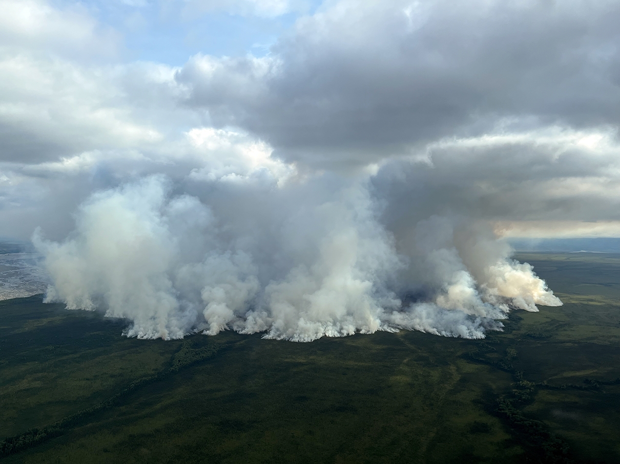
The 2023 Delta Fire burns in the Donnelly Training Area, west of the Delta Creek.
On Monday, July 24, 2023, lightning struck Alaska nearly 20,000 times.
“We just got kind of bombed,” said Matt Nunnelly, a state wildland firefighter, recounting that week. Each day brought more lightning, igniting wildfires scattered across the Interior.
Two days later, Alaska Department of Natural Resources initial attack wildland firefighter Matt Nunnelly and his crew responded to a new fire close to Fairbanks. The coordinates they received directed them north of town, just under two miles from a subdivision in the Goldstream Valley. As their helicopter approached, they caught sight of smoke.
But something seemed off to Nunnelly. Smoke drifted in from the wrong direction. He checked their coordinates.
As the helicopter continued north over a ridge, Nunnelly spotted five more sources of smoke wafting from the slopes of the Chatanika River valley – five more fires.
Meanwhile, dispatch announced new fires near Anderson and Clear, 70 miles to the southwest.
“Okay, it’s go time,” Nunnelly said into his helicopter helmet microphone.
By Friday of that week, lightning started over 100 new fires. What had been a notably quiet wildfire season suddenly took off as soon as everyone thought it was over.
A season of extreme opposites
The Bureau of Land Management Alaska Fire Service ended their Friday the previous week feeling tempted to call 2023 the lowest fire season on record. With fewer than 160 fires started and 2,000 acres burned, the 2023 wildfire season couldn’t even muster an appearance on a bar chart of acres burned per year since 1940.
Meanwhile, Canada experienced their worst wildfire season on record. By that point in the summer, over 4,000 fires had burned nearly 28 million acres across the country. Firefighters from around the world had deployed to Canada to assist, including 70 from Alaska.
During peak Alaska fire season, mid to late June and early July, wildland fire fighters respond to new fires near populated areas with full force. By late July or August, cool, rainy weather typically fades out the Alaska wildfire season, reducing the need for aggressive management. Around July 15, fire managers typically relax suppression efforts on remote fires unless they pose a threat to populated areas or if weather patterns look to remain hot and dry.

A firefighter looks down on the 2023 McCoy Creek fire from a helicopter.
With Alaskan fire crews and other resources tied up in Canada last July, firefighters that had stayed in Alaska like Nunnelly found themselves spread thin once the season finally got its unusually late start. With reduced capacity, suppression capabilities were not as they would have been earlier in the season.
Fire managers and meteorologists attempt to predict the likelihood of wildfire over the course of a season by looking at different weather and ground conditions including temperature, wind, rain and humidity. With all this information, they determine the dryness of vegetation, including a fire danger rating, from low to extreme.
But this information only provides a vague estimate of how severe a wildfire season could be, and forecasts constantly change as the season progresses.
Scientists, like the Alaska EPSCoR Fire & Ice Boreal Fires Team researchers, are looking into ways to improve wildfire forecasts with refined modeling tools. But the complexity that drives fire weather and behavior is difficult to pinpoint. Some researchers are experimenting with artificial intelligence to model factors that contribute to fire conditions, such as lightning, flammability of vegetation and how active fires spread.
Ingredients in a delicate recipe
Josh Hostler, a UAF PhD student, studies atmospheric patterns related to lightning, the main natural cause of wildfire, in tandem with fellow Fire & Ice researchers who each investigate other factors that contribute to fire, such as vegetation flammability, the timing of spring snowmelt, late summer rains and other weather patterns.
Hostler uses machine learning, a type of artificial intelligence, to look for patterns around when lightning strikes. His goal is to develop a tool for fire managers to forecast where and when lightning might start a wildfire, on both a daily and seasonal basis.
The Alaska Lighting Detection Network, maintained by the Alaska Fire Service, has collected lightning strike data since 1986. Hostler feeds this lightning data along with global hourly climate data into “self-organizing maps,” or SOMs. Hostler’s self-organizing maps look for similarities across thousands of data categories, then condense them into a two-dimensional output to represent what kind of atmospheric pattern occurred on each day. The self-organizing maps can then sort what kinds of patterns there were on days that had a lot of lightning and compare that to days with no or little lightning.
Hostler then takes the self-organizing map output data, and trains a random forest classifier, another machine learning model, to recognize patterns associated with high, low or non-lightning days. The random forest model can then make predictions on how much lightning is likely on a given day with known atmospheric conditions. The model has so far shown promise after making close approximations of seasonal lightning from the historic record, but Hostler is still refining it to improve its accuracy before releasing it as a finished tool for fire managers to base forecasts.
Attempting to forecast something as fickle as a wildfire season is tricky to get right, kind of like following a recipe for a delicate cake, Hostler explained. If an ingredient isn’t measured correctly, or the oven temperature isn’t right, the cake might not turn out well. The timing might be off.
“It's the same way for our fire seasons,” Hostler said. “Very small changes can basically just completely change the outcome for the season.”
Teleconnections
Some very small changes come from very far away. Scientists call such distant weather influences “teleconnections,” and their mysterious impact makes weather and climate challenging to model with high accuracy.
One notorious teleconnection at work is the El Niño–Southern Oscillation, or ENSO, a major driver of global weather patterns that originates from the see-sawing of ocean temperatures along the equatorial Pacific every 2-7 years.
“El Niño,” the warmer-than-average phase of the oscillation, blows warm air towards Alaska from the south, bringing warm temperatures and more precipitation along the coast, and less precipitation in the Interior. The opposite, cooler-than-average phase, “La Niña,” brings cooler temperatures across the state.
In May 2023, Fire & Ice collaborator Eric Stevens, thought the wildfire season would be a big one. The two of them tag-team the predictive services branch of the Alaska Interagency Coordination Center, or AICC. AICC is a fire response cooperative that umbrellas several state and federal agencies concerned with wildfire: the Bureau of Land Management, the State of Alaska Department of Natural Resources for whom Matt Nunnelly works, the USDA Forest Service, the National Park Service, the Bureau of Indian Affairs and the Fish and Wildlife Service.
Stevens thought 2023 would be a big wildfire year because a strong El Niño was forecast to push warm, dry air over the northern United States and Canada.
Fellow Predictive Services meteorologist and Fire & Ice collaborator Heidi Strader was skeptical. The El Niño influence wasn’t enough on its own to convince her it was going to be a big fire year. “Eric, it's like mid-May – there's nothing going on,” she said.
May and June passed quietly into sleepy July. “Well, I guess that was a bust,” they concluded about the El Niño idea.
But in hindsight, once the season flared up in late July after all the lightning and warm weather, Strader conceded that El Niño had perhaps played a role.
“We should have been ramping down, and instead we were ramping up,” she said. “So, I guess…the big El Niño that was coming did have an impact. It just didn't happen when we thought it would.”

Josh Hostler and Eric Stevens showed off weather maps and answered fire questions at the 2024 UAF Arctic Research Open House.
“As we get into the middle of the summer, we really don't have any drivers to tell us what's going to happen.”
Each day, Strader and Stevens put together a daily 15-minute fire weather briefing that guides wildland fire responders on their next moves. To inform their briefings, they mostly reference weather data products from the National Weather Service, who have “gobs of data” and a large, national team of meteorologists to sift through it 24/7. Strader and Stevens provide a “bigger picture of what’s going on” for fire weather in the near future, including how confident they are in the forecast.
“That's something that you often don't get from a National Weather Service product,” she said. “They put things in like the percent chance of rain, but people don't really understand that very well.”
But aside from weather data, Strader and Stevens don’t really have any good tools to predict fire risk longer-term – on a seasonal scale, or even a month or two out, Strader said.
“As we get into the middle of the summer,” Strader said. “We really don't have any drivers to tell us what's going to happen.”
One important indicator of fire risk is the dryness and build-up of flammable materials across the landscape. The duff layer - dense mosses, lichens, and dead plants – fuels severe wildfires when it is dry.
“But it doesn't tell us ignitions,” Strader said. “When is the lightning going to happen?”
Conditions could be highly flammable – hot, dry, windy – but with no spark, no ignition. Hostler’s machine learning-powered lightning prediction tool could add this insight to their forecasts, aiding in fire management decisions like where to allocate firefighters.
Creeping in
The advantage that artificial intelligence offers is “flexibility,” according to Hostler, compared to statistical or physics-based models that meteorologists use.
“I don’t know the underlying structure of this data,” Hostler said. But with machine learning, he can instruct his model to try on infinite ways to describe the data mathematically until the model finds the best-fit equation.
He cautions, however, that machine learning models are only as good as the data they’ve been trained on.
At the 2023 American Geophysical Union fall meeting, attended by over 25,000 people each year, Hostler found himself drowned out by a horde of other researchers trying out machine learning.
“Oh, you're just another one of the AI papers,” Hostler’s friends joked. “Like half the posters and talks…were on machine learning applications,” Hostler said.
Although Hostler touts the usefulness of AI to solve complex research problems, he is critical of the trend he was inadvertently crowded into.
“It looks like somebody took the problem they were working on and threw it into an AI model,” he said. “It gives them good results, and that's not necessarily that surprising, but the effort to go beyond that step is actually a lot bigger than I think people realize.”
In addition to good results, we need a “good theory” to make meaning out of what so-called artificial intelligence churns out. For example, ChatGPT’s capacity for eloquence comes from advanced human knowledge of how language works. But since we don’t have a strong understanding of complex natural phenomena like lightning, it’s hard to verify if a model is accurate or not.

Josh Hoster gave a poster presentation on his lightning model at the American Geophysical Union 2023 Fall Meeting.
Click here to download Josh Hostler's AGU 2023 poster.
Nonetheless, AI is “definitely creeping into a lot of aspects of fire science,” said Randi Jandt, Alaska Fire Science Consortium fire ecologist. Jandt loves following fire research news and sharing it in her newsletter titled, “Randi’s Roundup.”
At the annual spring fire operations meeting that the consortium hosts, Jandt presented “news you can use” to fire managers and fellow researchers. This year’s news was about a tool that uses machine learning developed by researchers in Colorado from the National Center for Atmospheric Research, the University of Colorado and the National Oceanic and Atmospheric Administration.
Their tool uses satellite and atmospheric modeling to produce an online map that shows daily fuel moisture content, a measure of how dry natural flammable materials are. Organic materials like the thick, mossy duff layer, leaf litter and dead wood become fuels in a fire, hence fire scientists call them fuels. Fire spreads rapidly when fuels are dry, so knowing fuel moisture content is critical to assess fire risk and anticipate what active fires will do next.
“It’s kind of magic,” she said to a room of people sitting at round tables in practical attire. This tool’s ability to analyze satellite data yields “wall to wall,” statewide fuel moisture content information that “fills in the gaps” of data otherwise collected from remote weather stations or field measurements. When Jandt had heard of this research, she reached out to the authors to request they include Alaska in their tool since remoteness is especially challenging in this state, and they agreed to.
Jandt offered to the fire managers at the spring meeting that the fuel moisture content map is easy for anyone to use and could add some insight about what parts of Alaska are the driest and most at risk of having a fire take off on a given day.
Machine learning tools haven’t yet become “mainline” in Alaska fire management, Jandt said, but they offer exciting new possibilities of analyzing fire conditions in real-time.
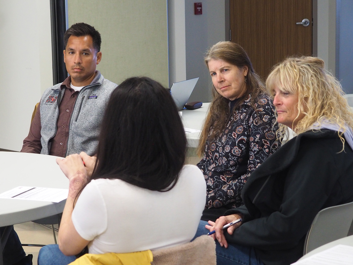
Alaska Fire Science Consortium fire ecologist Randi Jandt listens in a circle with fire managers at the Alaska Interagency Spring 2024 Operations Meeting at the Fairbanks Pipeline Training Center.
Heidi Strader is also excited for the potential of AI to be a radical new development for Predictive Services.
“It can pour through so much information so fast that humans can't,” Strader said. “And…maybe it can help to pick up on certain patterns that we just have not been able to identify yet. And I have no idea what those will be.”
Last year, Predictive Services tried out a new fire tool in development by a Canadian software company that uses machine learning, called FireCast. FireCast melds active fire data with weather and fuels modeling to predict how an active fire will spread in the next 24 to 48 hours.
Strader said the software has many features for comparing different kinds of models and scenarios, which was impressive. So far, however, they found it too overwhelming to incorporate it into their daily, time-sensitive operations.
“Part of the problem with what we do is there's so much information out there,” Strader said. “Figuring out what to use and get an answer in a timely fashion is challenging.”
Strader and Stevens only have less than two hours to put their daily briefings together, so they need information that is clear and quick. They don’t have time to evaluate the accuracy of complex tools and new research in their noisy, open-cubicle office, but she hopes to hire new staff this year who could focus solely on this kind of analysis for them. Their mutually beneficial partnership with Alaska EPSCoR Fire & Ice researchers also allows them to incorporate new fire science into their work and offer feedback on the researchers’ work.
“Using AI…it's not going to happen right away because there's going to be so much trial and error with it,” Strader said.
Another barrier to incorporating new fire forecasting tools into daily operations is government regulation that guides fire management decision-making, according to Jandt.
“There is an interagency plan on how to manage fires,” Jandt said. “And the federal government and the state governments…both have procedures that you follow.”
But new tools can still be used to compare to mandated tools, and machine learning is already infiltrating some of the data, like the fuels mapping, she said.
“I think it’s open season,” Jandt said.
Predicting the future
Meanwhile, Josh Hostler hopes to have his lightning forecast tool finished and available for fire managers by summer 2025.
“They’ll still probably take it with a grain of salt,” he said. Like all forecasting tools, he explained, it’s just statistics – a mathematical guess of how likely it is something might happen.
Jokingly, he self-deprecated that if he were “better at his job,” it would have been already finished and in the hands of fire managers last year. If fire managers had known that a blitz of late-July lightning was on the calendar ahead of time, would they have made any decisions differently?
“It's hard to say,” Strader said. “Would we still have been able to make enough of an impression on the fire managers to say, ‘keep your resources tight?’
“Also, would that have been the right answer?” Strader said. “Because then you're depriving other places of having resources, and Canada was on fire. They were burning up whole towns! We didn't lose any towns, we just ended up being busy for a while at a time of year that we're not normally busy. So. Ah! It's hard!”
“Canada absolutely needed those resources,” said Matt Nunnelly, from initial attack. Aside from a few tense moments when additional aircraft or staff were not available, he doesn’t “think about it too much” when upper tiers of fire management “kind of move their pawns around on the chess board” to move resources where they are needed.
Nunnelly doesn’t think too much about seasonal forecasting either beyond what’s forecast for the next week and what’s happening moment to moment, which is more likely to be accurate.
Regardless of what the weather will be, his goal right now is to train new people on his team to make sure they are “ready and prepared” to safely handle what the season throws at them.
“Whatever comes, we'll have to deal with it,” Nunnelly said. “Kind of a major attitude in fire that's helpful is: no expectation. Everything's constantly changing, and most of the time, stuff doesn't work out the way you want it to. And so, holding on to ideas of how things are going to go isn't helpful.”
So far this year, nothing stands out to suggest anything other than a “normal” wildfire season, Strader said. Yet for some reason, Strader has a hunch 2024 could be another “really busy” wildfire season.
“I don't know why. I don't have anything to substantiate that,” she said. “Just a gut feeling.”
As of June 11, 2024, 107 human-caused wildfires have burned under 3,000 acres, and 10 lightning-caused wildfires have burned roughly 28,000 acres. The active McDonald Fire in the Tanana Flats is primarily responsible for this acreage.