Fire and Ice
“Fire and Ice: Navigating Variability in Boreal Wildfire Regimes and Subarctic Coastal Ecosystems (F&I)" is a 5-year, $20 million effort by Alaska NSF EPSCoR to conduct research into changes to fire risk and behavior in Alaska’s boreal forest, and changes to physical and chemical variables that influence biological communities in the nearshore Gulf of Alaska. The award runs from October 1, 2018 - September 30, 2023.
Here is a brief overview video of this current phase of Alaska NSF EPSCoR research:
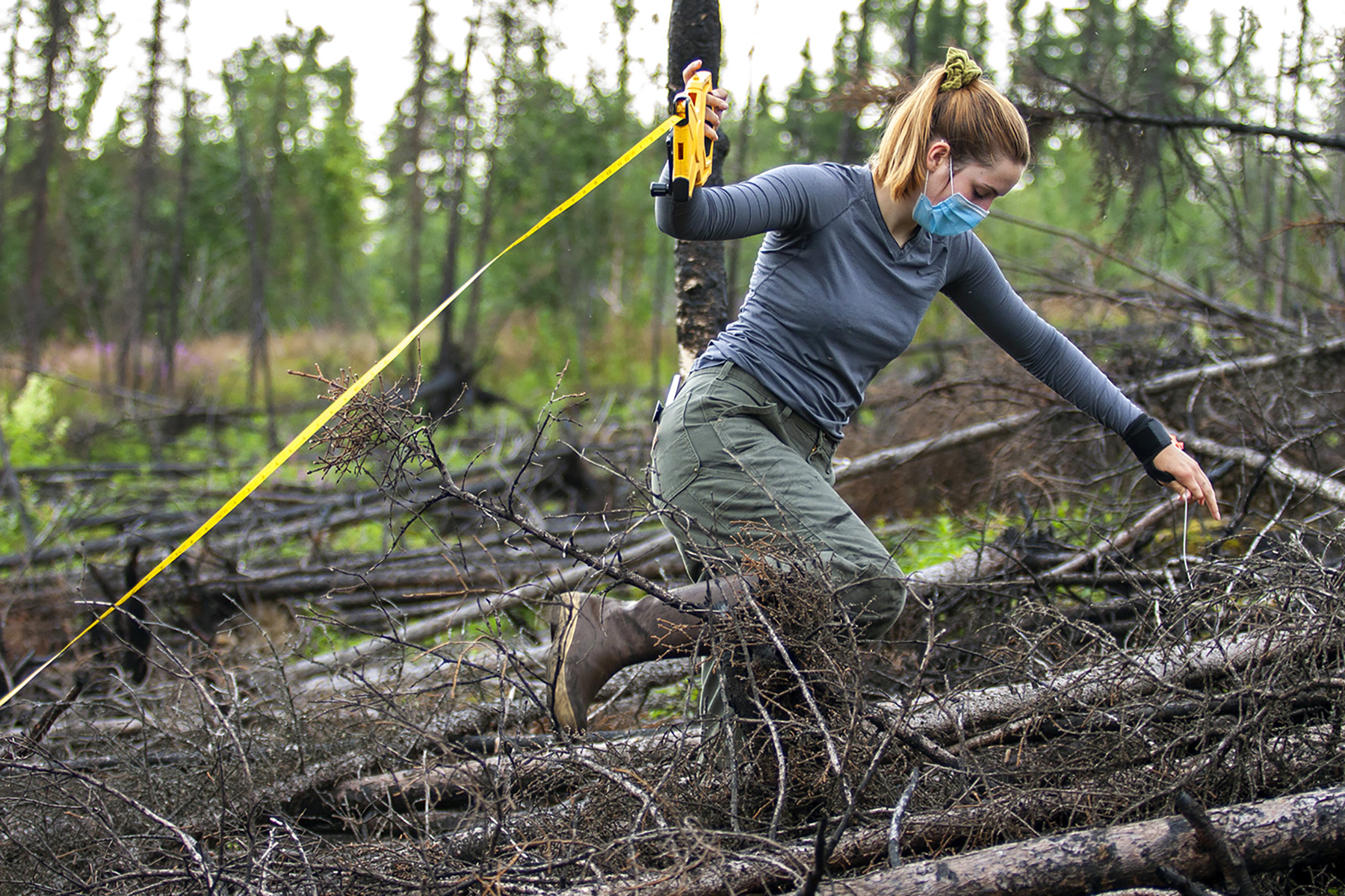
Fire & Ice Boreal Fires student Colleen Haan lays down a transect in the Shovel Creek burn outside Fairbanks, July 30, 2020.
EPSCoR researchers from across the University of Alaska system are employing remote sensing, in situ monitoring, laboratory experiments and modeling to examine these changes, and are using social science methods to gauge their potential effects on local residents. The project is divided into three major components: a Boreal Fires team, a Coastal Margins team, and Diversity, Education and Workforce Development (DEW) team, which helps to share findings and to educate Alaskans in STEM fields. Other aspects of the project include Communications, Economic Development and Management efforts and Collaborations with numerous agencies and organizations.
The goal of the Boreal Fires team is to increase community resilience to wildfire by improving evaluations of short-term fire risk, predictions of fire behavior, and understanding of fire mitigation strategies and of wildfire impacts on ecosystem services. Researchers focus on Interior and Southcentral Alaska and use climate modeling, fieldwork, hyperspectral remote sensing, and survey approaches to address their research questions.
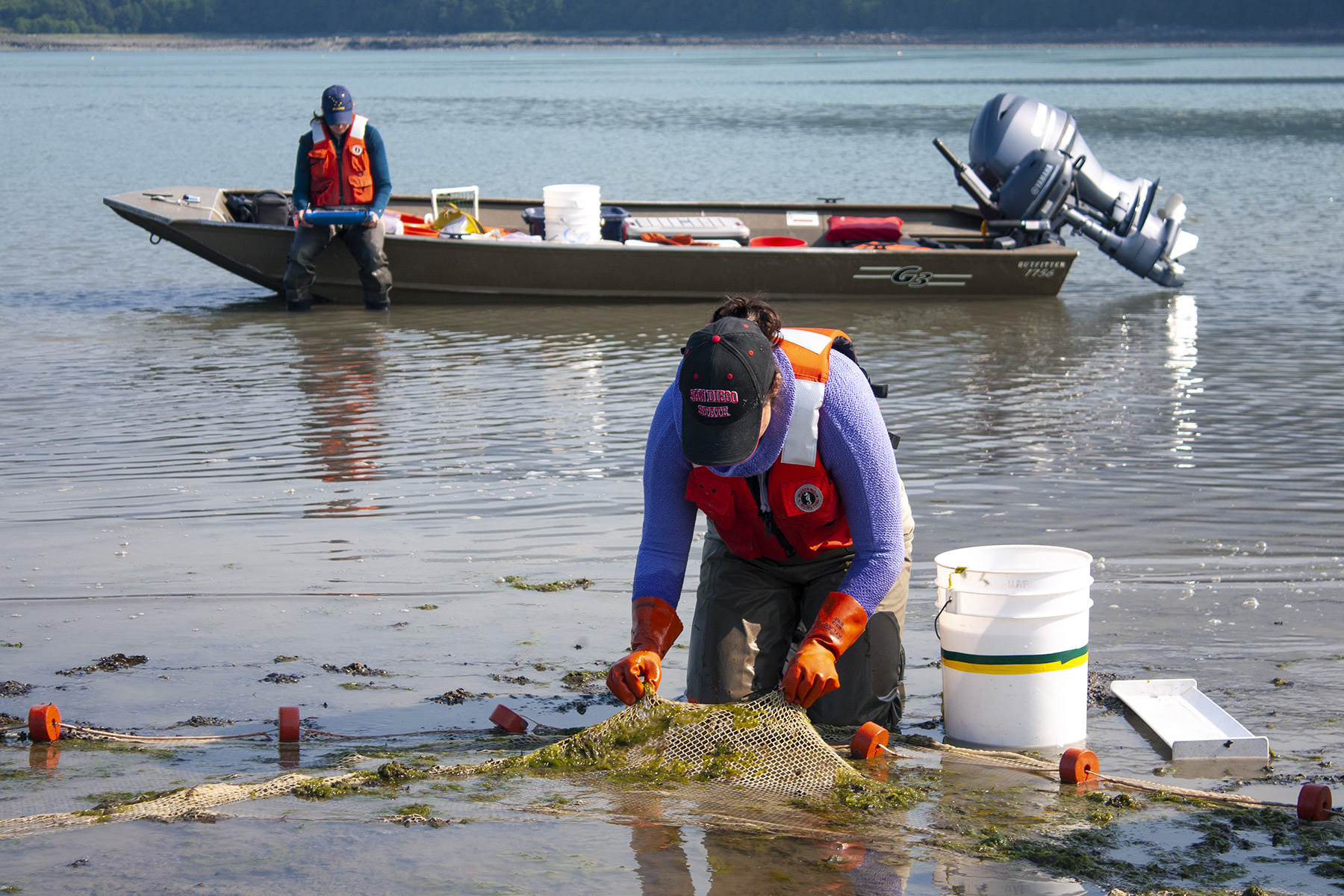
Fire & Ice Coastal Margins student Madison Bargas examines fish in a beach seine as component co-lead Anne Beaudreau takes notes at Cowee Creek outside of Juneau, July 4, 2019.
The goal of the Coastal Margins team is to evaluate the impacts of large-scale ocean drivers and climate-driven landscape changes on glacial and non-glacial estuaries along the Gulf of Alaska, and to provide information to improve resource management and community resilience. Researchers focus on the causes and impacts of changes to freshwater discharge into the Gulf, which have major effects on coastal ecosystems and species of economic and cultural importance. They combine fieldwork in Kachemak Bay and Lynn Canal with climate modeling, laboratory work, surveys and analysis of existing data to address their research questions.
A Diversity, Education and Workforce Development (DEW) team partners with researchers to involve more Alaskans in Fire and Ice activities, including K-12 out-of-school programs and teacher workshops; scientific expeditions for high-school girls; and UA mentoring, courses and trainings. DEW also conducts research into science identity formation in first-generation college students, who are a focus of F&I diversity efforts, along with women and Alaska Natives.
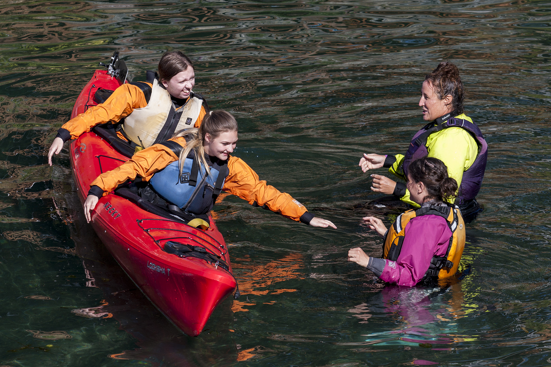
Participants in the Fire & Ice Girls on Water program learning to kayak at the Kasitsna Bay Laboratory, in Kachemak Bay, August 4, 2019.
Other elements of the project include a Communications component that keeps the public informed about project findings and progress; an Economic Development program focused on sponsoring and organizing activities that encourage science, technology, engineering and math (STEM) entrepreneurship; Collaborations with federal, state and local agencies and organizations; and a Management structure that ensures the project meets its goals and objectives.
Brenda Konar of UAF serves as Project Director and Principal Investigator of the project, which will involve a total of more than 30 faculty members located across the three main UA campuses, as well as five new faculty hires, six postdoc hires, 44 graduate and 45 undergraduate research assistantships. For an overview of Fire & Ice progress through 2022 check out our exciting 2022 Update. Also visit our Impacts page, and for detailed descriptions of goals and timelines see the Fire and Ice Strategic Plan.